I love these simple, practical uses of augmented reality. The Maps team writes,
Last month, we launched Live View in Location Sharing for Pixel users, and we’ll soon expand this to all Android and iOS users around the globe. When a friend has chosen to share their location with you, you can easily tap on their icon and then on Live View to see where and how far away they are–with overlaid arrows and directions that help you know where to go.
Live View in Location Sharing will soon expand to all Android and iOS users globally on ARCore and ARKit supported phones.
They’re also working hard to leverage visual data & provide better localization and annotation.
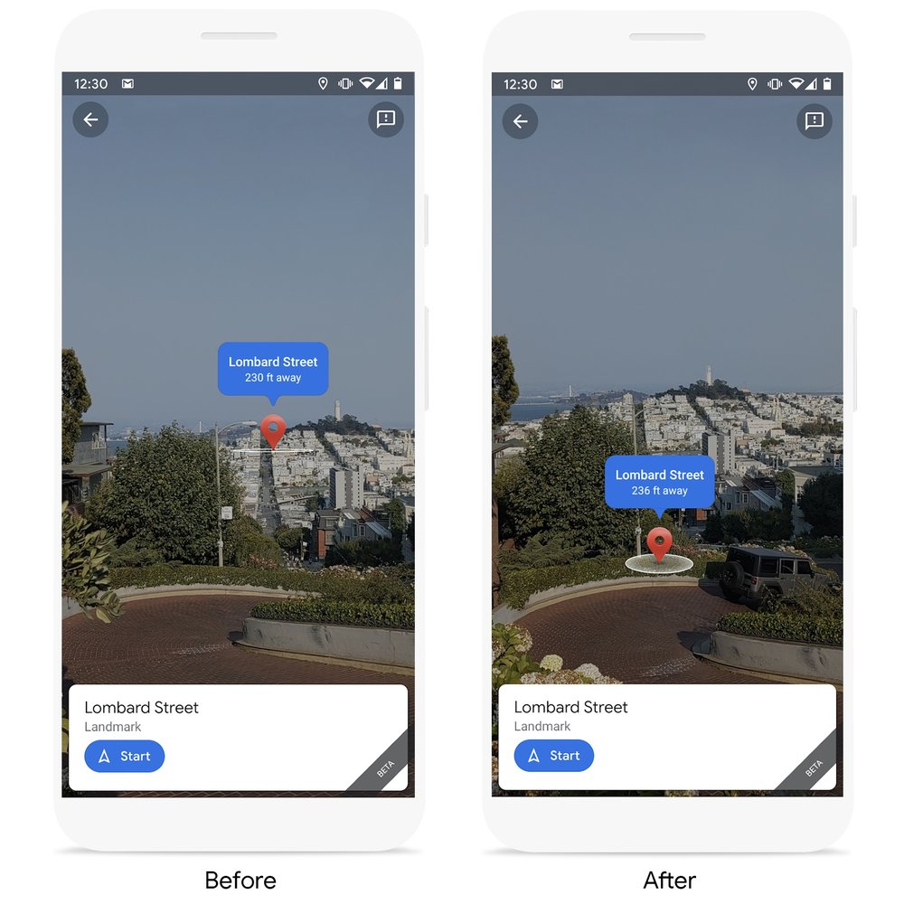
With the help of machine learning and our understanding of the world’s topography, we’re able to take the elevation of a place into account so we can more accurately display the location of the destination pin in Live View. Below, you can see how Lombard Street—a steep, winding street in San Francisco—previously appeared far off into the distance. Now, you can quickly see that Lombard Street is much closer and the pin is aligned with where the street begins at the bottom of the hill.